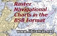
 Here is a huge collection of the selected raster navigational charts presented in the "BSB" format. All of charts contained in the pack were developed and released by the Maptech. The list of the charts include ones for Adriatic Sea, Canada, France, Germany, Mediterranean, Norway and so many other areas.
These charts are full color digital images of the paper charts. All charts are fully compatible with most of marine navigation software commonly installed on board ships. The charts are approved by the US NOAA, standing for the National Oceanic & Atmospheric Administration and the format used is quite widespread.
Needless to say that it is recommendable to have such set of navigational charts provided the software you possess supports the format the charts are presented in, i.e. BSB. The charts will be excellent when used for training purposes or for actual navigation of the vessel in the areas covered.
 We strongly recommend all our visitors to have a close look into this excellent collection of the software products developed by the world recognized experts and officially released by TRANSAS - the package presented to your attention includes such useful applications as TRANSAS Navigator, Tsunamis'99 and Chart Catalogue, supplemented with the Installation Guide and numerous Help Files, Dongle Checker Program v.1.05.18, and Troubleshooting Aid v.1.2.56.
Though the program interface is in English, the electronic help files included in the package have been presented in three languages - English, French and Portuguese. Developed for and compatible with all Windows. No viruses or any sort of malware. No need for activation. Just download and use these program and navigate safely. A really great and remarkably useful collection for all mariners - it is also perfect when used for training purposes.
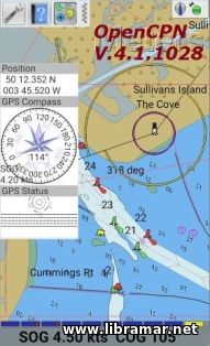 The version of the popular OpenCPN software developed for Android. As it is the case with the regular windows versions, it enables users to create concise chart plotters and navigation software; the program may be used underway or as a planning tool.
Same regular features are available in this release - single-chart, quilted, Chart-up, Course-up display modes, waypoint navigation, support of the most popular formats, OpenGL support, weather routing, AIS input and support for SAT and auto MOB handling, autopilot output support, and so many other useful and necessary functions.
As usual, this software is multilingual with more than twenty languages supported. Note that the version 4.8.0 for Windows and for Mac including all necessary plugins and chart support are also available for download and ready use.
 The present learning application was specifically developed to explain to the users virtually everything they should know about such important piece of navigational equipment as compass, concentrating on both gyro and magnetic types of compasses. The application contains information about the compass variation and deviation plus gyro error.
Note that they are first clearly explained in the theoretical section of the program and then some practical application is demonstrated in the calculator section. the users are enabled to perform calculation of the heading directions from map to compass and from compass to map, i.e. in both directions and for both types of compasses covered. You should also note that these calculations can be used not only for the learning purposes but also in real life cases.
One of the most practical features of this application is that the results of the calculations do not only show the output values; the calculation process itself is detailed to allow better and easier understanding. The theoretical part of the application is instructive and informative so shall be treated as a very good reference - the material is arranged in nine easily accessible sections. Install this application on any of your android-based devices and have a good and effective training.
 The official release of the ChartPlanner by Datema - this software was developed to assist users with the management of their electronic charts and is widely used within the shipping industry due to its proven effectiveness and ease of use. There are two versions of the program available differing with the type of supported ENC charts, the functionality is same.
This set contains the installation files for the software supplemented with the detailed user's manual which will guide you through the installation process, provide all required operational instructions, give all necessary information about the BA, ADP and NP documentation, NtM service and using the notices to mariners. The first section also specifies the minimum requirements for installing subject software so that you can check if your computer suits them and proceed with the installation.
In fact the requirements would easily allow any computer to have this program installed and working effectively. The instructions are given for all versions of Windows OS up to and including Windows 10. Traditionally, we guarantee clear installation pack with no viruses, malware or any need for payment. Have this software installed and use it to enhance the nautical safety.
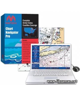 This is an excellent and very useful chart plotting and GPS-planning program developed by the Maptech specialists. The novel features of this version of the software include enabling the users to view the real time position of their vessels on the computer screen. The minimum system requirements are quite low and will allow this program to be installed and operated on any modern computer.
The software works with both ENC and VEC charts. Among the other features of this program we would underline the compatibility with the AIS, 3D navigation aids, full coverage of the United States, chart warping including the overlaying/warping your available raster charts. Another function is to warn the user of the potential risks of ship grounding on the basis of the current speed and course.
In fact, you could also install this program on any computer to get some training and practice – it would be beneficial to get some good preparation before you start operating it on board your ship, to make sure you are duly aware of all functions and controls of the software. Note that this program has been considered the flagship of all navigation products released by Maptech by now, and is very widely used.
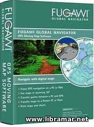 This application is definitely one of the best software items for the ship route planning as well as GPS navigation. It is also an ideal one to be applied for the real-time navigation. Using this program, the navigators will be able to handle their vessels safely using the wide variety of the electronic maps.
The software is very convenient for tracking and any information can be added to the receiver at one click. The waypoints and routs can subsequently be downloaded for their analysis. The users are enabled to create their routs on the chart and exchange the information between the desktop computer and any portable device, such as the tablet or GPS. All of the maps can be viewed in 3D format. When installing the application, make sure that the computer has an active internet connection.
Also, the Administrator Mode and then Automatic Activation shall be selected during the installation. The system requirements allow it to be installed on nearly all computers with the operation system starting from XP. The Furuno plotters are now supported allowing the data transfer. The program is in wide use all around the world and is appreciated by the ship navigators. Download it and enjoy the experience of the safe navigation.
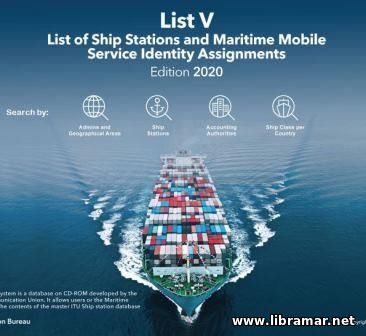 The software was developed and released with the intention to provide users with the readily available ITU list of stations and MMSI assignments. The very latest version of the application allows search by the admins and geographical area, ship stations, accounting authorities, and ship class per country.
The subject ship station retrieval software is a perfectly compiled database that was specifically developed by the ITU. The application provides all users with an opportunity to consult the whole content of the database. For example, if you want to search by ship station, the information required from you will be the MMSI and ship’s name, her call sign, Flag name, EPIRB, country – at least something from this list. The software is very user-friendly and can be used by all people.
No installation required, so all you need to do is just launch the file and start searching using any of the options provided by the developers. No need for any registration and/or payment.it is absolutely official and legal so there is no need to apply any cracks or codes to use it. Thoroughly checked for viruses and free of any sort or malware. Save a copy and keep it on your computer to make sure it is readily available at all times.
|


