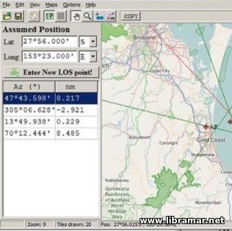
 Have a look in this simple and easy-to-use software. The program will provide aid to those interested in celestial navigation. It has been designed to perform calculations of the geographical position on the basis of the celestial observations. The subject observations are normally utilized to fix the position of the users by LOP, standing for the Line of Positions, in the automatic manner.
Among the features of the program we would name the plotting of the Sun, Moon positions as well as those of the four planets and as many as fifty-six stars. Moreover, the software is capable of providing the names of the plotted objects together with their azimuth and altitude. The users will be able to identify any of the available objects by simply clicking the mouse, while the mouse wheel can be used to increment and decrement the time.
Also, they will be enabled to create both linear and polar plot at any position and time, load and save the data, draw and calculate the longitude and latitude. The program will be perfect when used for both practical and training purposes. The file was verified to be free of viruses and any malware so feel free to install and start making steps towards becoming a good celestial navigator.
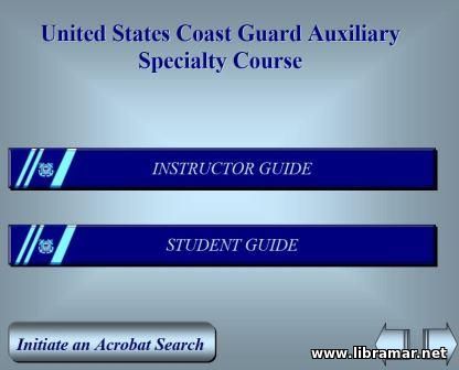 Here is absolutely excellent training software released by the USCG. The intention of the authors of this course was to provide the candidates to the Navigation Specialist role with the extensive and thorough training, covering one of the critical mariner skills. The material of the course is arranged in two major parts, upon completion of which the trainees should be considered able to perform all navigation activities on a small craft with sufficient confidence and accuracy.
There are eleven sections, starting with the introduction and essentials of navigation, then the main navigator’s tools including compass, dead reckoning etc. The piloting occupies two following sections, while the rest of them are devoted to the tides and currents, e-navigation, radar plotting and other important areas. Note that there are several appendices providing additional information.
It is strongly recommended to go through the content of the course either on your own or, preferably with the instructor. Even if you are not going to sail in the United State waters, the materials contained in this training resource will be useful to you. Just make sure you follow it carefully and pay enough attention to details.
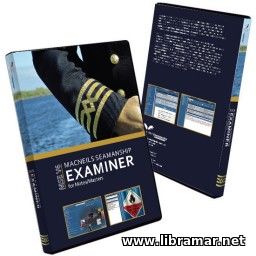 According to the numerous reviews from people all around the planet who used this resource, it can definitely be used as an excellent computer-based study pack, very useful for all future Mates and masters. The material included in the package covers all important theoretical and practical aspects of the seamanship as well as collision avoidance.
In addition to the above, the content includes correct answers to the questions related to the safety of the vessel, cargo handling, ship security, maritime business, law and insurance, bridge procedures, hours of work and rest, ISM/ISPS and many other topics. The ro-ro vessels have also been addressed, together with the LNG ships, chemical carriers, bulk carriers, transportation of the various dangerous goods by sea, coal and grain carriage, LNG/LPG operations, etc.
Absolutely must have training tool for all participants of the maritime industry willing to improve their knowledge of ship handling and maritime transportation, and particularly useful for those preparing for the examinations. The relevant international regulations have also been covered. The list of acronyms and abbreviations included for easier use of the program.
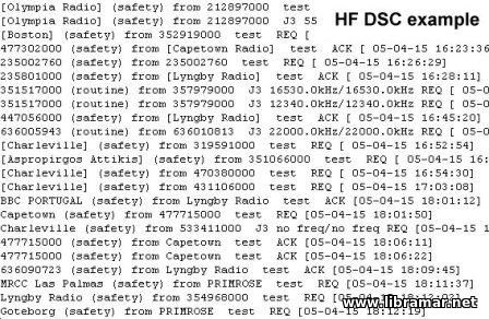 Another useful software developed to be used by the navigators. The program will enable the users to decode the maritime mobile service messages by means of the DSC system plus the DGPS and Navtex broadcasts. The only thing you need is the computer and sound card.
The DSC is used in the MF/HF/VHF bands for communication between vessels and coast stations. in order to get the messages decoder, the MF/HF/VHF band radio receiver will be required and tuned to one of the available DSC channels or, alternatively, to any Navtex channel.
The software will decode the received digital data and display and further log subject messages. The program will work on any computer, even on the old models and has no malware.
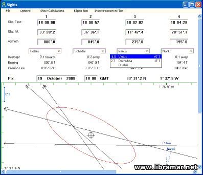 This program has been developed to be used as a definitive astronomical reference, a sight calculator or just for the daily printout of the Nautical Almanac pages (for the full range of dates). The sights can be easily plotted and combined. Enter the altitude and bearing and you will get the list of potential bodies, and the ambiguous lights will get apparent immediately.
The other data available, such as twilight information, Eclipses, Moon phases or a Star Chart, are comprehensive. An absolutely recommended piece of software for the marine navigators, very simple and easily used, such approach of the developers has made this program very popular among navigators, since the user interface is clear even for the beginners.
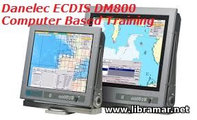 Here is the specifically designed and developed computer-based ECDIS training. Introduction; ECDIS interface; ECDIS setup; Installing data; Charts display; Voyage preparation; Navigation; Navigation information tools; Other navigation tools; Troubleshooting; List of input sentences; List of output sentences; Algorithm and examples of manual position fix by range and bearing LOPs.
The present pack includes the practically useful User Manual for the Dolphin ECDIS, numerous official Danelec study exercise, plus the Installation manual for ECDIS hardware, etc. Needless to say that the content of the training course will be greatly appreciated by the people whose day=to-day activities are connected with the use of the electronic charts. In addition to that, this training will be very recommended to be taken by the students.
 The complete set of electronic charts which have been presented in the "S-57" international exchange format. These digital vector nautical charts are produced to the IHO standards. The fully vectorised charts were developed using the best data currently available for the areas covered.
This set includes the charts for the following areas: Austria, Denmark, Croatia, Czech Republic, Serbia, South China Sea, Italy, Netherlands, Romania, United States and Spain.
This pack is intended to be used by the ship/boat/yacht navigators and trainees providing them with all necessary information. Use these electronic charts and have safe navigation.
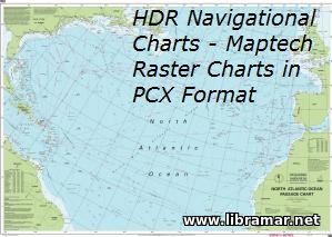 The set offered to your attention comprises of the navigational charts which have been developed for the following three geographic areas - Atlantic General, Belgium & Holland, and Portugal. These are Maptech raster charts made in PCX-based format.
These navigation charts are expected to be of some use for mariners navigating intending to perform voyages to the above stated areas. They may also be used for training and educational purposes by future mariners. The format of the charts is pcx.
Save them in case you need when navigating in the above mentioned areas, as a reserve source of info.
|


